The Coleridge Way Route Guide
WALK FROM THE QUANTOCK HILLS TO EXMOOR (51 MILES)
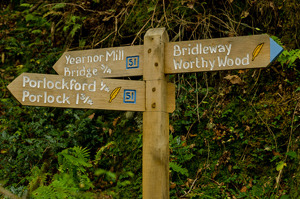
The Coleridge Way route is waymarked with quill signs and can be followed by using the detailed route guides and maps. These route guides are subject to change as the route is improved and developed. Please check you have the latest version before setting out.
The route can be extended to the Valley of Rocks near Lynton using the South West Coast Path. Details of this are included in the route directions.
Ordnance Survey maps covering the route are:
- 1:25 000 OL9 Exmoor
- 1:25 000 140 Quantock Hills and Bridgwater
- 1:50 000 181 Minehead and Brendon Hills
- 1:50 000 180 Barnstaple and Ilfracombe area
These maps are available from Minehead Information Centre /105/visitor-information
Walk the route eastwards from Lynmouth to Nether Stowey with these guides:
Eastwards with directions only
Walk the route westwards from Nether Stowey to Lynmouth with these guides:
